
We never started any of our previous trekking vacations with such optimism. I remember talking about the fact that nothing can really surprise us anymore while we were walking the first few meters of our tour. This year we want to hike the Kungsleden from Jäckvik to Ammarnäs and from there all the way to Hemavan. That way we would complete the missing section this year and finish the Kungsleden.
Have we really seen it all?
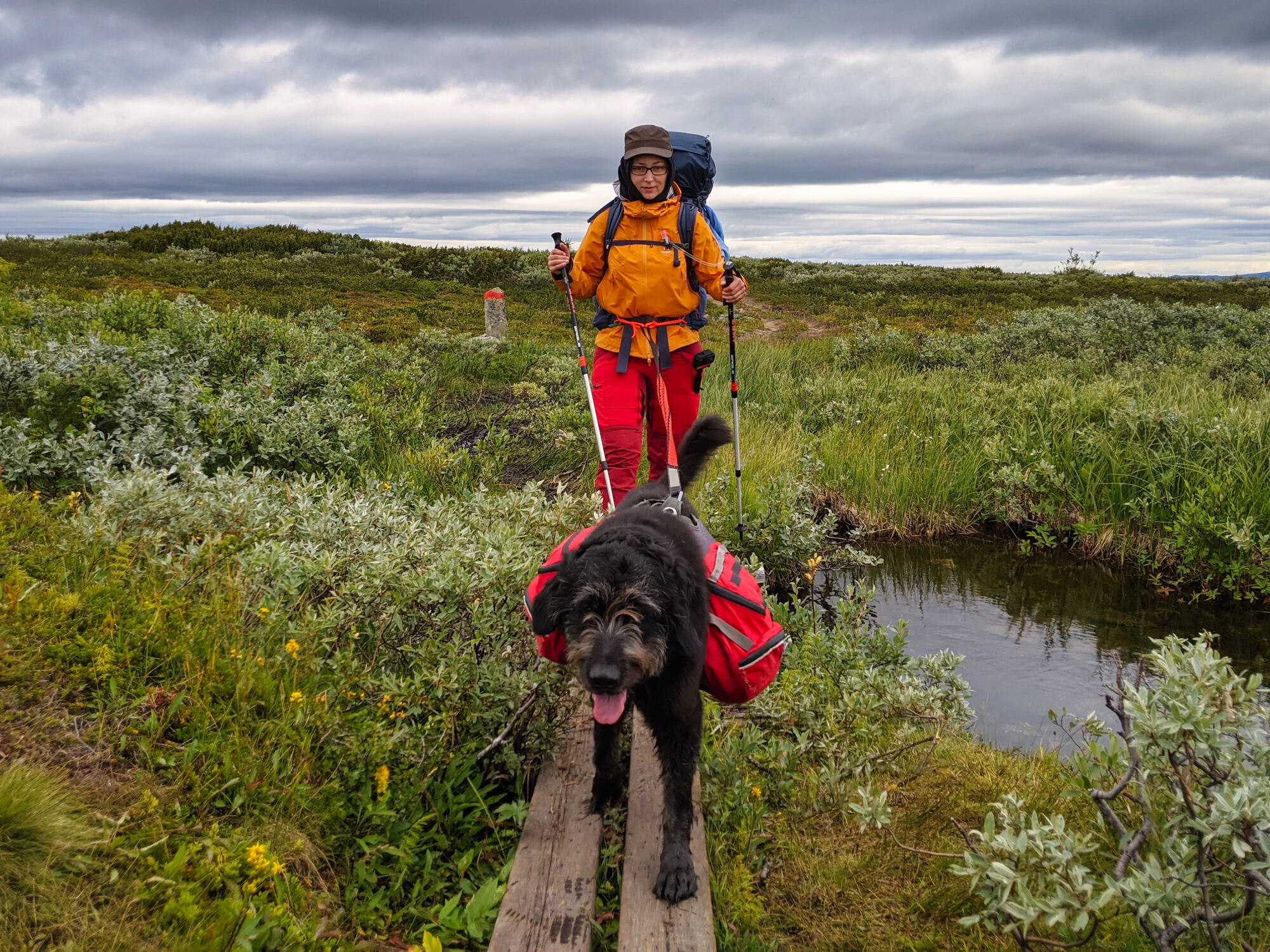
On the tours of the past years we have actually experienced everything: from snow and frost to hot days without shade. Midnight sun, mosquito attacks, melting snow, river crossings and mentally exhausting sections. We lost our way and learned to navigate better. In addition, our backpacks are lighter this year than last because we can buy supplies in between. So what else could throw us off track?
A story of failure – but still with a happy ending!
Therefore, we are confident to complete the Kungsleden with the missing section between Jäckvik and Hemavan. What we do not suspect: everything will turn out quite differently than planned. The rough nature of Lapland will prove us wrong and we will discover that we have by far not experienced all of its facets.
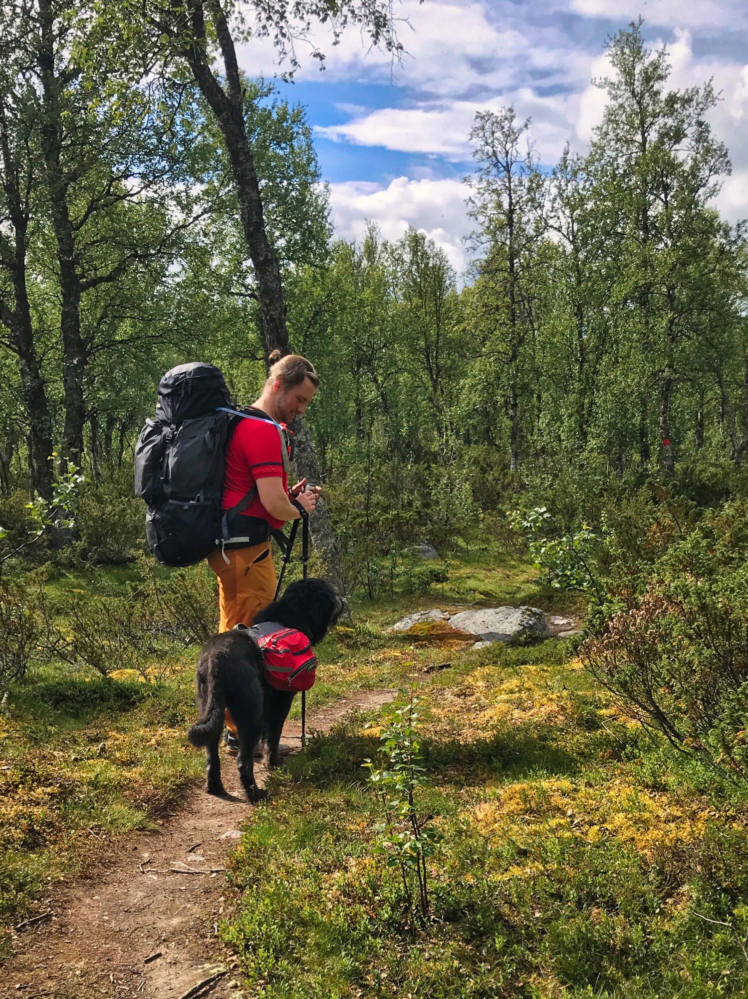
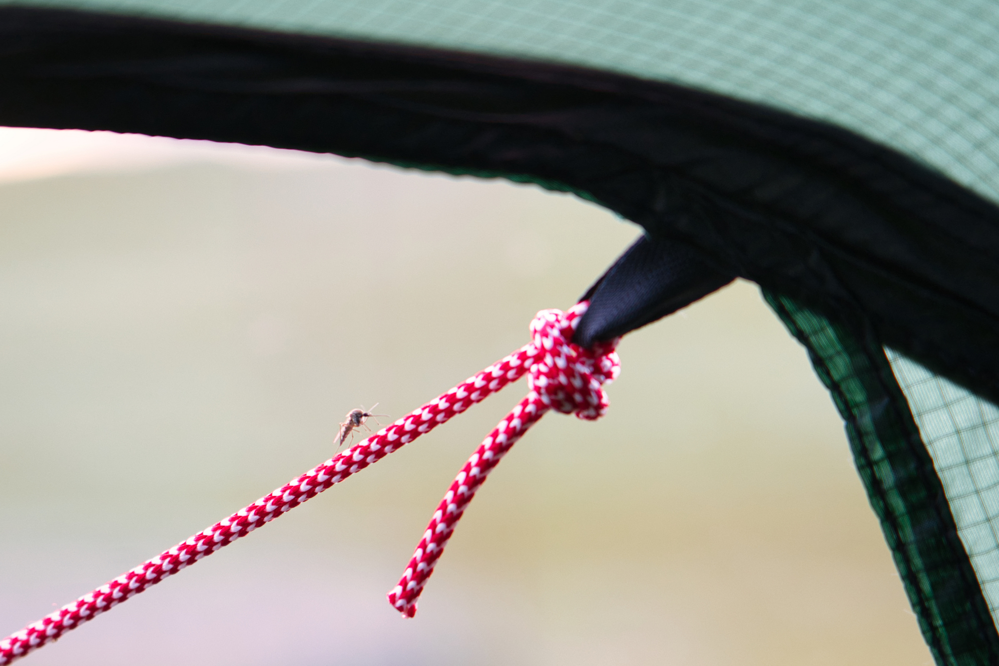
In addition, the section between Jäckvik and Ammarnäs is very different from the Kungsleden we have known so far. It has a lot of forest and dense vegetation. The wide views that we love so much are much rarer here. Instead, mosquitoes and midges accompany us particularly intensively this year. Since we were unable to schedule the vacation any other way, we are on the trail at the beginning of August this year.

Find out what we experienced on the tour and why we will probably come back again to finish the Kungsleden by reading our tour reports (coming soon), which we have linked to you here. Experience our adventure on the Kungsleden once again!
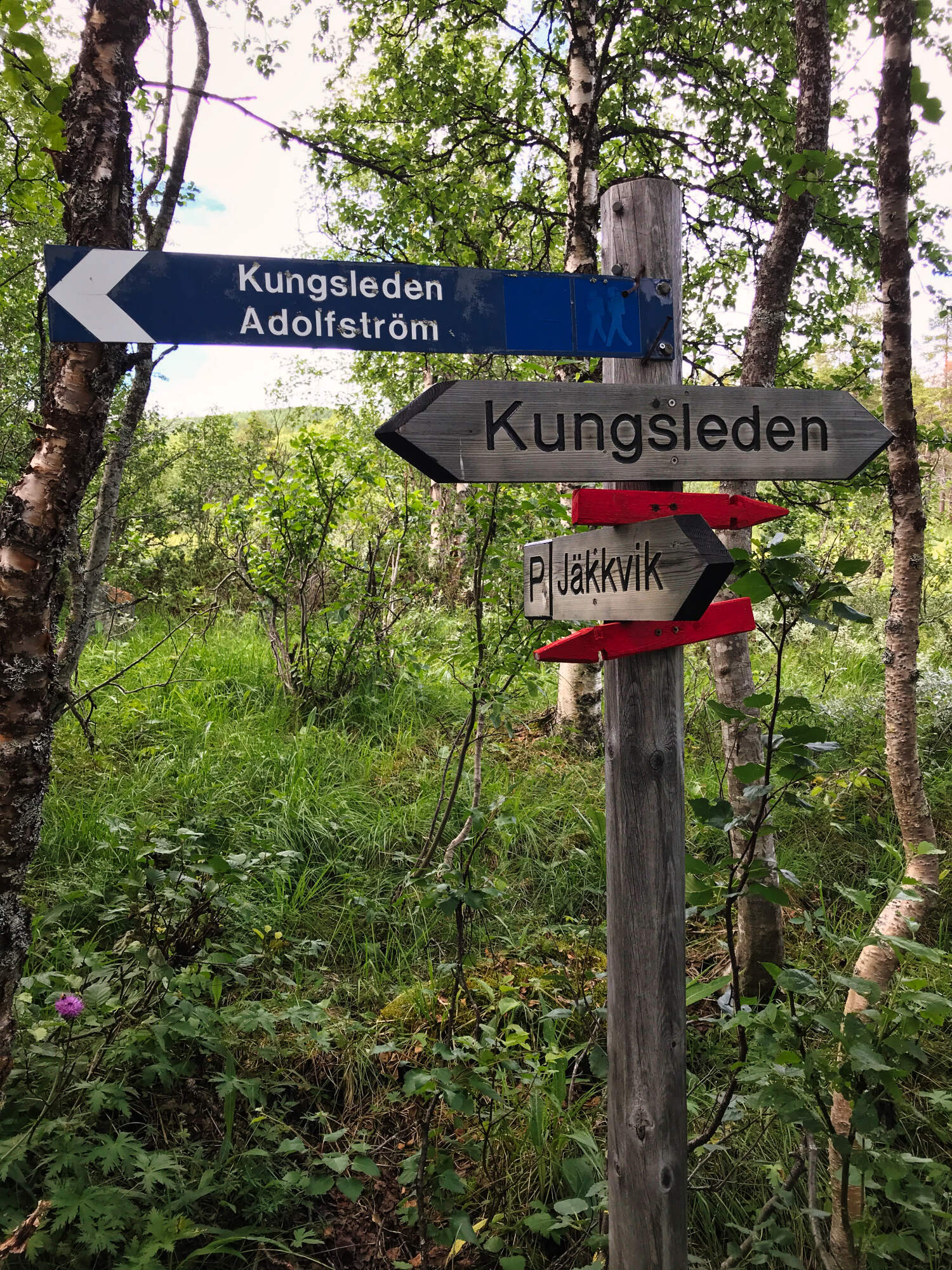
Kungsleden from Jäckvik to Ammarnäs
Day 1: Jäckvik – first bridge behind Pieljekaisestugan
Day 2: First bridge behind Pieljekaisestugan – Bäverholmen
Day 3: Bäverholmen – Sjnullttjie
Day 4: Sjnullttjie – Bridge at Lisvuojuhka
Day 5: Bridge at Lisvuojuhka – Rävfallsstugan
Day 6: Rävfallsstugan – Ammarnäs
Start in Jäckvik
Description

Day 1: Jäckvik - tentsite
Profile
Description
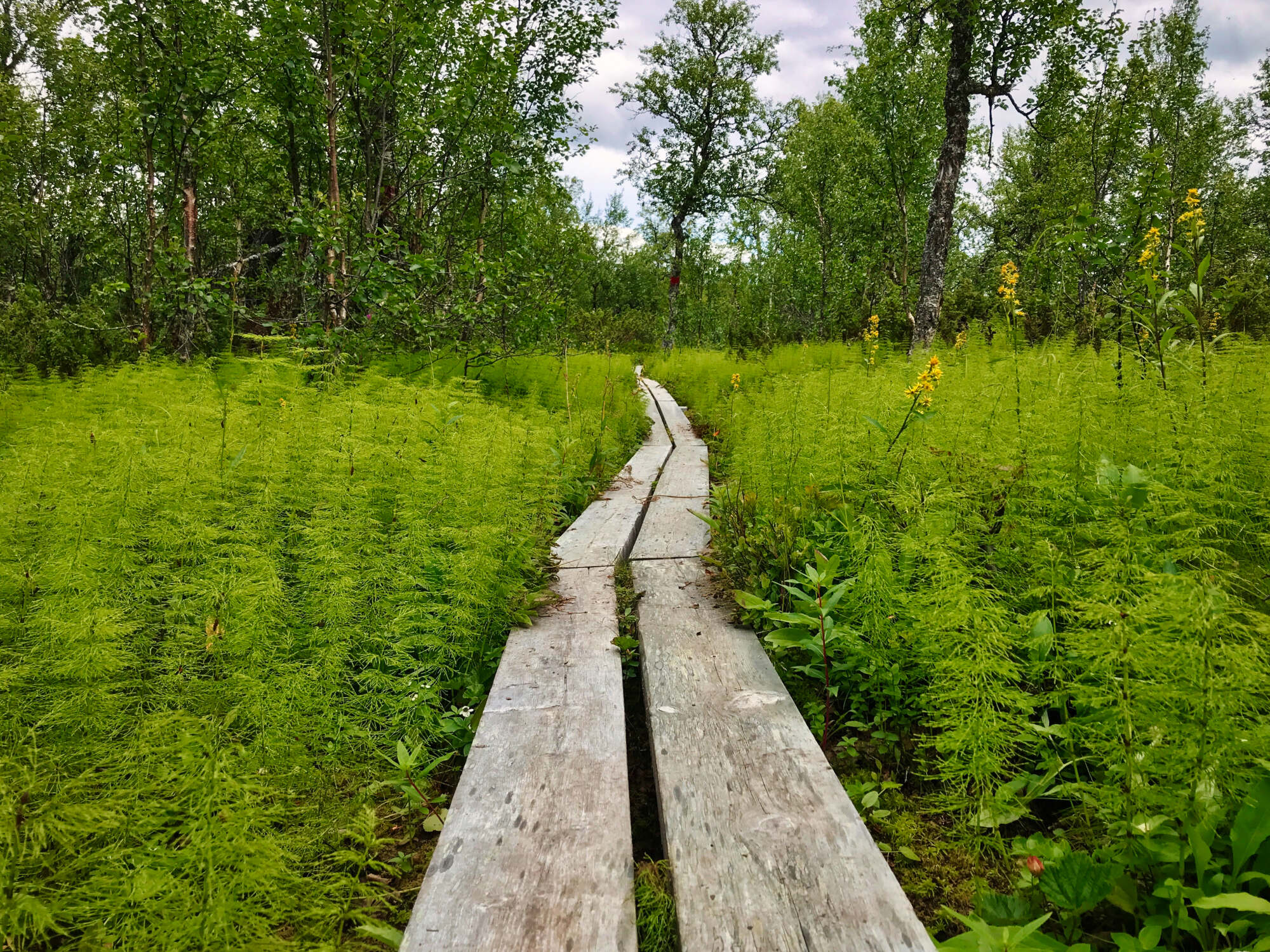
On the section south of Jäckvik, the Kungsleden leads through forest. Especially on slopes there are also many stone boulders, so it is advisable to look for suitable campsites early. If you start looking when you are tired, you might be surprised to discover that you have to walk a few more kilometers before a good spot comes along.
Campspot after Pieljekaisestugan
Description
Behind Pieljekaisestugan the terrain is steep and wooded. There are no good campsites. However, about 1.3 km after the hut and right before the first bridge, there is a wonderful campsite with a bench and a fireplace.
Day 2: Campsite - Bäverholmen
Profile
Description
We fight our way through forest and dense vegetation on our way to Adolfström. There we have to decide: continue along the lake through dense forest or take the motorboat. We don’t think long and cross over to Bäverholmen by boat.
Wärdshus Bäverholmen
Description
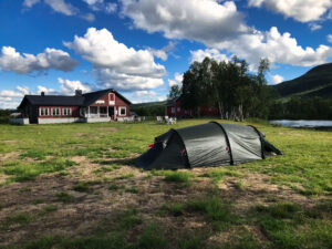
The Wärdshus offers a total of 35 beds. Around the guesthouse you can camp on the meadow and the price also includes the use of showers and toilets. Restaurant and sauna are an additional highlight.
Day 3: Bäverholmen - Sjnulttjie
Profile
Description
The stage from Bäverholmen to Sjnulttjie is exhausting: although the path is good to walk, mosquitoes and bugs annoy us on this leg! Attention when planning the overnight stay: within the bird sanctuary you are only allowed to camp in designated places.
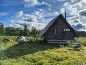
Sjnulttjie
Description
Inside the Sjnulttjie hut we find the typical furnishing of Swedish shelters: a table with a bench, a fireplace, some firewood and a broom. Right next to the hut we find a reasonably plain campsite.
Day 4: Sjnulttjie - Bridge at Lisvuojuhka
Profile
Description
A great stage with fantastic scenery and wide views. The Kungsleden crosses now the border between the Swedish provinces of Norbotten and Västerbotten. There are plenty of campsites everywhere.
Bridge at Lisvuojuhka
Description
At the bridge at Lisvuojuhka there are many possibilities to camp. Due to the river, the water supply is assured. But there were a lot of midges sitting in the grass.

2 comments
Hello Catharina, what a beautiful site you have, I enjoy reading it. but I have a question . the route Jackvik to Ammarnas the last 3 stages cannot be opened, (4,5,6) you can still change that, I really want to read them.
thank you. Greetings Marian
Hej Marian,
you are right, I have all the articles written but not reviewed yet, that’s why they are not published. I did at least a bit of my homework and just published day 4. I promise, I will go through the remaining two days and publish them shortly! Have fun reading them 🙂
Katharina